🌍UN Promotes Accurate World Maps, 164 Votes in Favor
The Mercator Map's Days Are Numbered?
TL;DR
The UN passed a resolution promoting maps that accurately show continent sizes, like the Equal Earth projection. Despite 164 votes in favor, the US was the sole dissenter. The resolution encourages use in schools and tech companies, but won't force changes on Google Maps or Apple Maps.
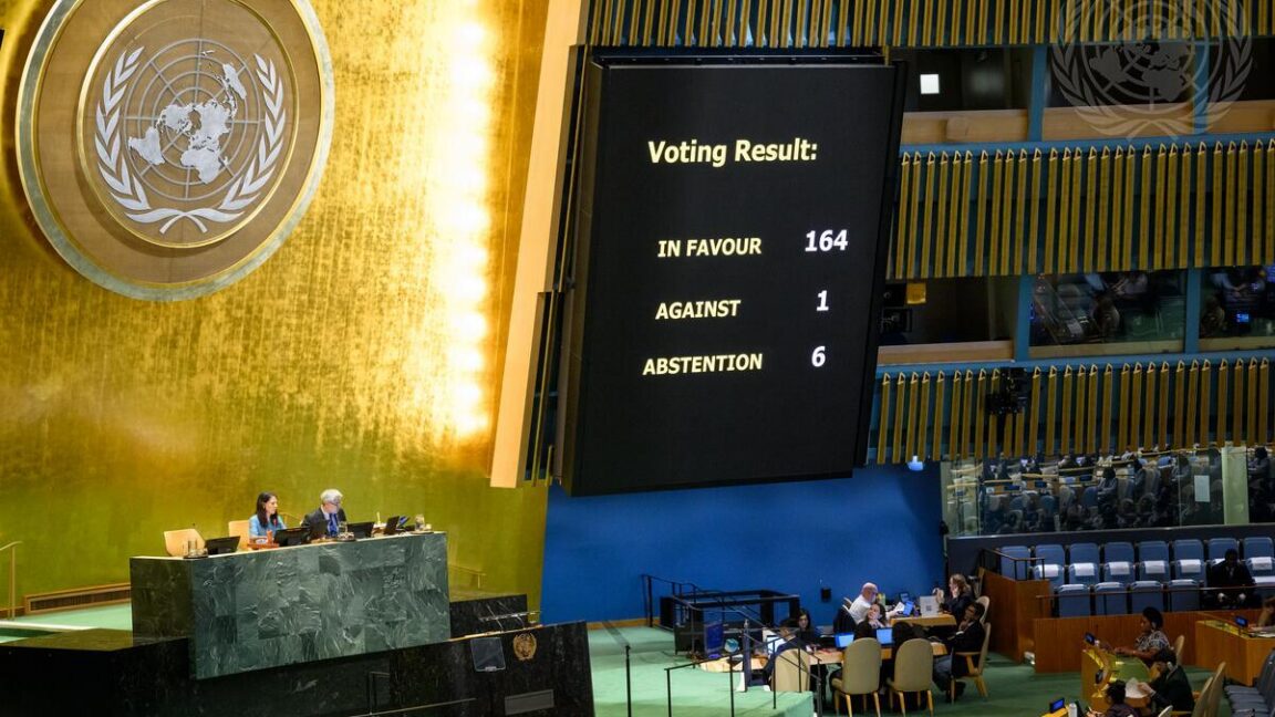
The UN General Assembly voted overwhelmingly in favor of a resolution to promote world maps that accurately represent the size of continents. With 164 votes in favor and only the US voting against, the resolution encourages the use of equal-area projections like the Equal Earth map. This shift is crucial for developers and educators, as it impacts how geographic data is visualized and understood. The Mercator projection, still widely used in navigation apps like Google Maps, distorts the sizes of continents, making Africa appear the same size as Greenland despite being 14 times larger. The resolution aims to correct this by teaching about map trade-offs and encouraging the use of projections that preserve area accuracy.
Key Points
UN resolution passed with 164 votes in favor, 6 abstentions, 1 against (US).
The Equal Earth map projection was developed in 2018 to accurately represent landmass sizes.
Google Maps, with over 2 billion monthly users, still uses variations of the Mercator projection.
Mercator map distorts sizes, making Africa appear same size as Greenland, despite being 14 times bigger.
Study found people more accurately estimate country sizes when familiar with Robinson map projection.
Why It Matters
If you're developing geographic applications or teaching cartography, the shift towards accurate projections like Equal Earth is crucial. The Mercator map's distortions can mislead users about relative sizes and shapes, impacting everything from navigation to geopolitical understanding. However, the resolution's non-binding nature means tech companies like Google and Apple will likely continue using Mercator projections in their apps for now.
Frequently Asked Questions
Why does this matter?
If you're developing geographic applications or teaching cartography, the shift towards accurate projections like Equal Earth is crucial. The Mercator map's distortions can mislead users about relative sizes and shapes, impacting everything from navigation to geopolitical understanding. However, the resolution's non-binding nature means tech companies like Google and Apple will likely continue using Mercator projections in their apps for now.
What happened?
The UN passed a resolution promoting maps that accurately show continent sizes, like the Equal Earth projection. Despite 164 votes in favor, the US was the sole dissenter. The resolution encourages use in schools and tech companies, but won't force changes on Google Maps or Apple Maps.
Comments
Be the first to comment
Enjoyed this article?
Get it daily. 7am. Free. Reads in 5 minutes.
Join 3,472 builders reading daily.